 I've been riding for more than 2 weeks now, and thought I'd post a few pics of a typical ride home for me.
Here's an overview map of the first few pictures.
#1: Leaving Bike Locker
#2: Heading East on Burnside
#3: Heading East on Ash
#4: Entering Tom McCall Waterfront Park
BTW, Google Earth is a wonderful tool for doing stuff like this.
This is the view right after I leave my bike locker in downtown Portland. My building is back behind me, and I'm headed west. I'm about to turn right onto Broadway and travel one block before turning onto Burnside and heading towards the river.
Mary's Club is straight ahead in this picture, it's one of 3 or 4 strip clubs in downtown Portland (there's one right across the street from my building in what used to be a Cuban restaurant) Portland has the highest per-capita number of bookstores, coffee shops, and X-rated establishments in the US, which pretty much describes Portlanders: eat, drink (we also have over 200 microbrews), read and have sex.
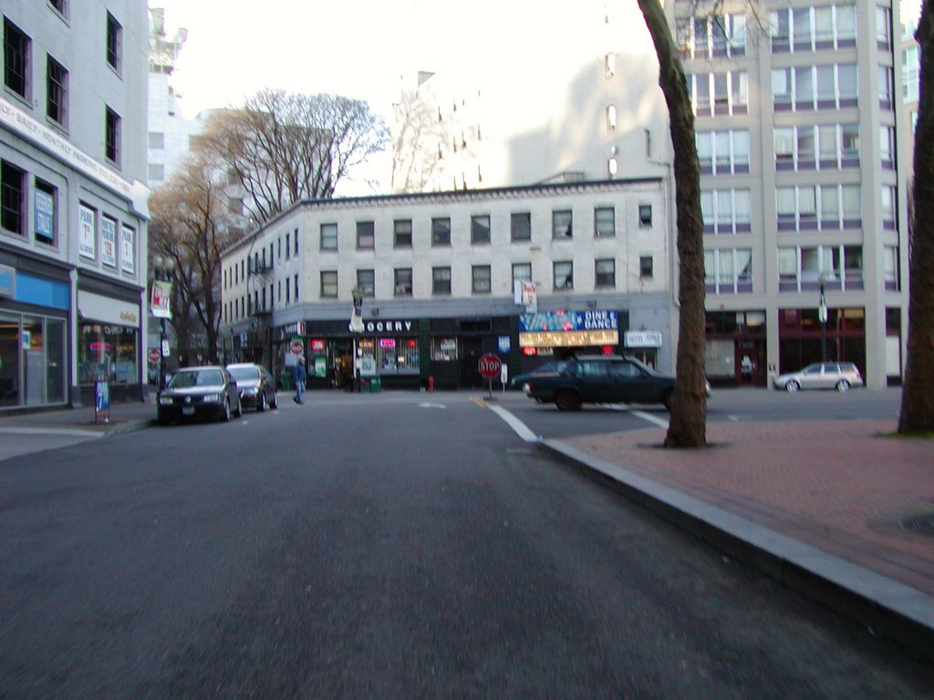
 I've just turned off Broadway and onto Burnside. The building ahead and to the right is the Unico US Bancorp Tower, where I work. It doesn't look like much from this position, but it's actually 42 stories tall. I work on 15, which is actually the 14th floor because the building has no floor 13.
Burnside is one of the busiest streets in Portland, and the intersection I'm about to go through is one of the 3 most dangerous in the city for pedestrians. (It's not so bad for bicycles)
I usually ride about 3-4 blocks down this road and then go right a couple blocks before

continuing east to Tom McCall Waterfront Park.
Ok, in this third picture, I'm on SW Ash, heading east towards the Willamette River, which is only a few blocks away. We're about 20' above sea level here at best. The City of Portland rests at sea level at the confluence of the Willamette and Columbia Rivers. The Willamette remains at sea level up past downtown and the Columbia sits at sea level for more than 90 miles from Astoria all the way up past Troutdale into the mouth of the Columbia River Gorge. The rest of the city not adjacent to the rivers ranges from 20' above sea level in the downtown areas to 1,100' in the western hills near downtown and the volcanic hills to the east like Mount Scott.
 Picture #4 - I'm entering Waterfront Park now, and directly ahead of me is the Willamette River (pronounced Will-LAMB-it). On the other side is Portland's Eastside warehouse district, which is sort of undergoing a revitalization right now. If there weren't clouds in the distance on the right, you'd be able to see the peak of Mount Hood, Oregon's highest mountain at 11,240'.
Ok, so once I get into the park, I turn right (south) and start heading down to the Hawthorne Bridge so I can get across the river. Portland is called the city of bridges, and for good reason: just by car alone, you can cross the Willamette on the St. John's Bridge, the Fremont Bridge, the Broadway Bridge, The Steel Bridge, the Burnside Bridge, the Morrison Bridge, the Hawthorne Bridge, the Marquam Bridge, the Ross Island Bridge or the Sellwood Bridge.
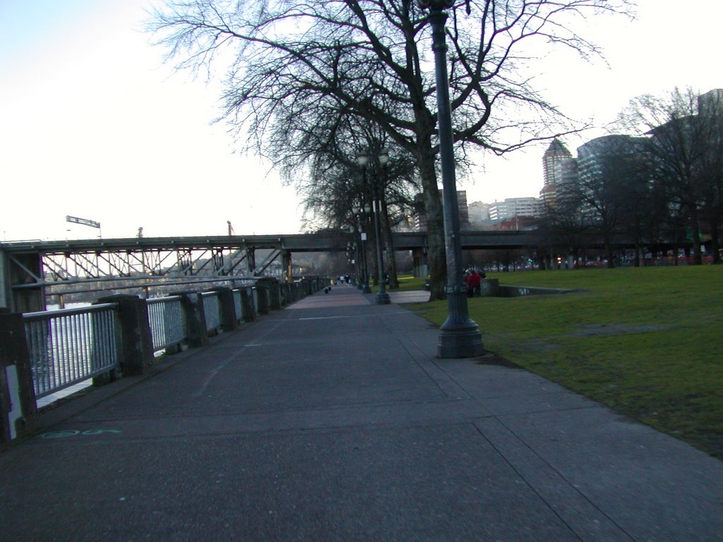
Here I am riding through the park, with the Morrison bridge coming up ahead. I ride under the Morrison Bridge and cross at the Hawthorne near the south end of the park.
This is a rare view of the park - green grass and no obstructions. It only lasts until May 1st. On or around May 2nd, a zillion trucks come in and set up tents, rides and other items for Portland's annual Cinco de Mayo fest. After that, the grass is trampled into mud. Every 2 weeks after that, someone sets up for another big event, from early May all the way to Labor Day. By that time, any remaining grass is brown or dead, and the city re-seeds everything. By late October we've gotten rain again and the grass seed usually grows back out.
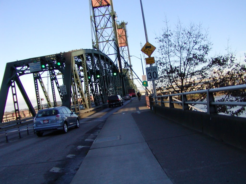 Here I am at the Hawthorne bridge. I'm now about 20' above the park after having successfully navigating a circular on-ramp up to the bike lane. A few years ago, they rebuilt the sidewalks on the sides of the Hawthorne Bridge and made them much more pedestrian and bike-friendly.
Once I get some pictures of my improvised camera mount, I'll put them up on the blog. Basically, a screw and a couple of nuts, washers and a wingnut are holding the camera on my handlebars, allowing me to take all these pictures while riding.
Part Two coming up later!
-MPP
No comments:
Post a Comment